Explore the landscapes of Parinacota province, where trails rise above 4,000 metres across the high Andes
NORTHERN CHILE · ANDES · PARINACOTA
ABOVE 4,000 METRES, THE ANDES CHANGE THE WAY YOU WALK
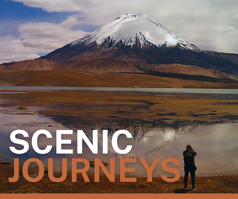
In the far north of Chile, the Andes rise into a vast high-altitude landscape shaped by volcanoes, salt flats, wetlands and mountain lakes.
Here, trekking takes place in an environment where altitude becomes part of the experience.
Above 4,000 metres, the air is noticeably thinner. The pace slows. A short climb can feel demanding, and the body begins to remind you that the mountains operate on a different scale.
But altitude is only one part of the story.
The highlands of Parinacota are also a living landscape. Vicuñas move across open bofedales. Flamingos gather around high-altitude wetlands. Volcanic peaks dominate the horizon, while ancient routes connect places that have been part of Aymara territory for generations.
Walking here requires more than good legs.
It requires acclimatization, pacing, awareness of the terrain and respect for the environment.
From the volcanic lagoons of Cotacotani to the coloured mountains of Suriplaza, these five experiences reveal different sides of the high Andes of Northern Chile.
01 — LAGUNAS DE COTACOTANI
Volcanic lagoons beneath the great peaks
LAUCA NATIONAL PARK · APPROX. 4,300 M · SCENIC TREKKING
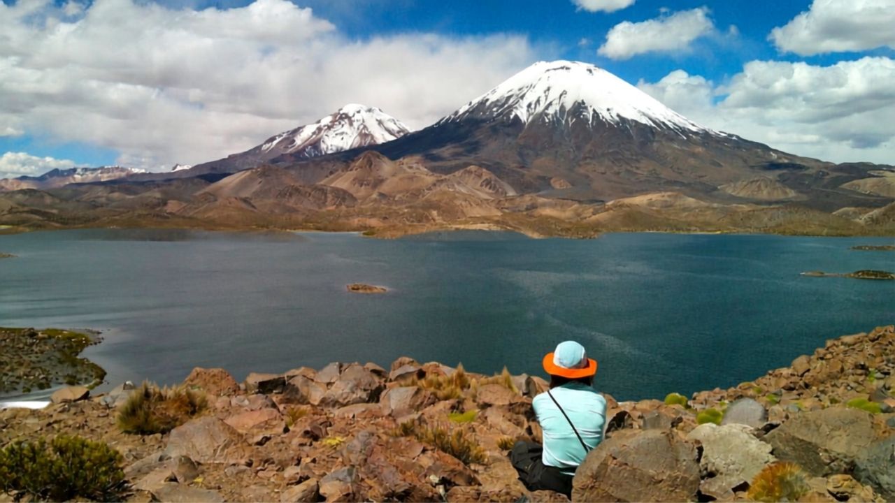
Few places illustrate the volcanic character of the Altiplano as clearly as Lagunas de Cotacotani.
Located within Lauca National Park, the lagoons form a complex landscape of water, volcanic rock and wetlands beneath the surrounding high peaks.
The terrain is open and exposed, with very little vegetation to interrupt the immense scale of the landscape.
For trekkers, this is not necessarily about gaining a summit.
It is about reading the terrain.
The route moves through high-altitude ground where every change in elevation becomes noticeable. The combination of altitude, dry air and intense solar radiation means that maintaining a steady rhythm is more important than speed.
A good strategy is simple:
Walk slowly. Breathe deeply. Keep a consistent pace.
At this elevation, the strongest trekker is not necessarily the fastest one.
The landscape rewards patience.
The relationship between the lagoons, volcanic formations and surrounding peaks creates one of the most distinctive trekking environments in Northern Chile.
THE TREKKING EXPERIENCE
Best for: Landscape · Photography · Nature · Acclimatized hikers
Terrain: High-altitude volcanic terrain, open ground and uneven surfaces.
Altitude: Approximately 4,300 metres.
Technical consideration: Moderate altitude exposure. Acclimatization and controlled pacing are important.
In the high Andes, efficiency means knowing when not to rush.
02 — SALAR DE SURIRE
Where flamingos meet the high Andes
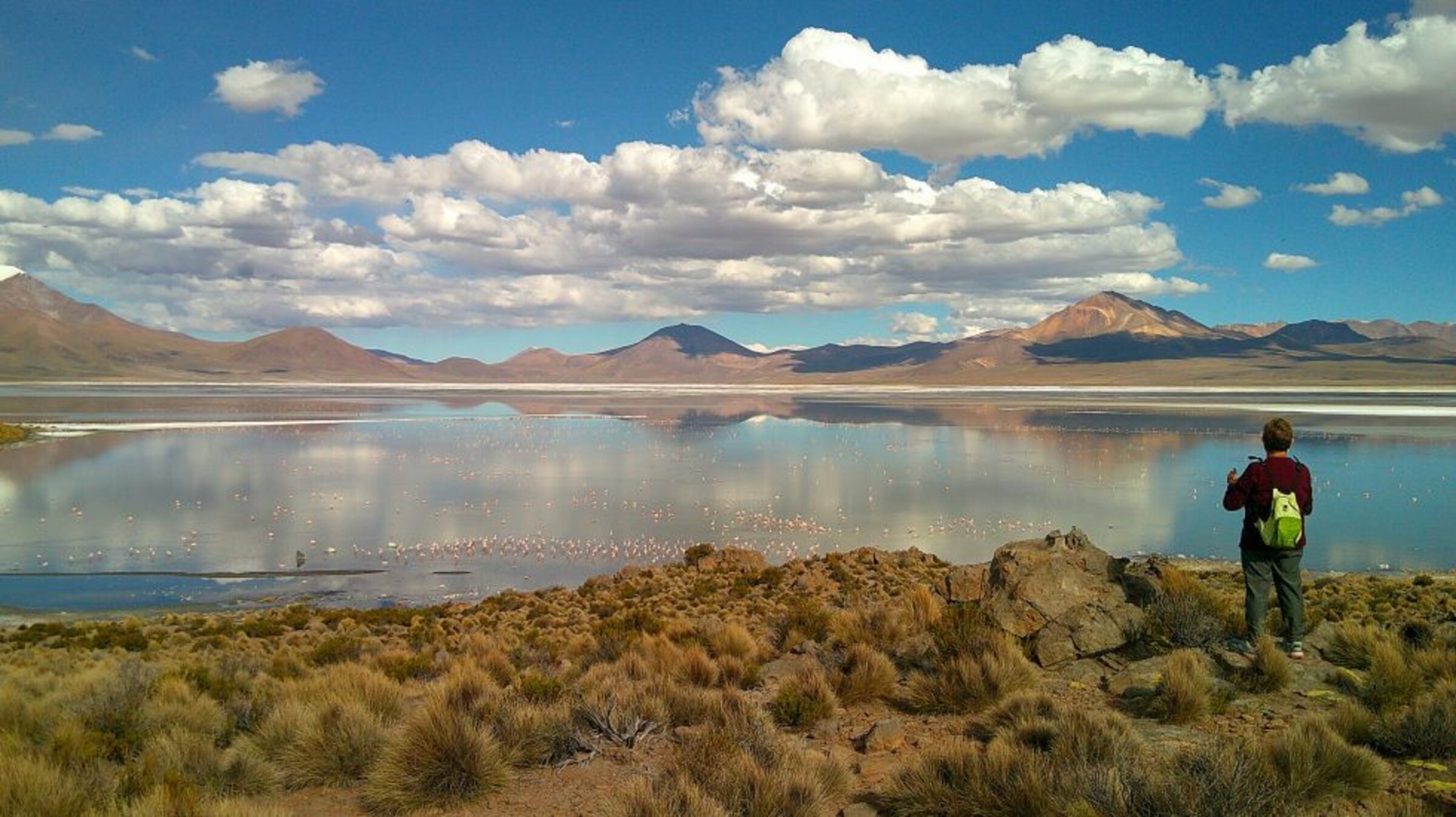
MONUMENTO NATURAL SALAR DE SURIRE · APPROX. 4,250 M · WILDLIFE & LANDSCAPE
At first glance, Salar de Surire appears almost empty.
A vast white salt flat stretches across the Altiplano, surrounded by mountains and volcanic landscapes.
But the apparent emptiness is deceptive.
Surire is one of the most important high-altitude wetlands of Northern Chile, supporting wildlife adapted to extreme conditions.
Three species of flamingo can be observed here, together with vicuñas and other characteristic species of the Andean highlands.
The landscape is also part of the Lauca Biosphere Reserve and has been recognized internationally as a Ramsar wetland.
For trekkers and nature travellers, Surire offers a different experience from a conventional mountain route.
The objective is not simply to climb.
It is to move slowly through an ecosystem where wildlife, geology and water exist at the limits of survival.
The scale of the landscape can make distances difficult to judge. A mountain that appears close may be much farther away than expected.
This is one reason why high-altitude travel requires careful route planning.
And then there are the flamingos.
Against the white salt crust and dark volcanic mountains, they create one of the most remarkable wildlife scenes in the Chilean Altiplano.
THE TREKKING EXPERIENCE
Best for: Wildlife · Photography · Birdwatching · Landscapes
Altitude: Approximately 4,250 metres.
Terrain: Salt flat margins, wetlands and open high-altitude terrain.
Technical consideration: Exposure to altitude, cold, wind and intense solar radiation.
Wildlife: Flamingos · Vicuñas · High-Andean birdlife.
Surire is a reminder that the Altiplano is not an empty landscape. It is an ecosystem adapted to extremes.
03 — LAGUNA CASIRI
A remote landscape at the edge of the high Andes
NEAR CAQUENA · APPROX. 4,800 M · REMOTE TREKKING
Some trekking experiences are defined by the summit.
Others are defined by how far you feel from everything else.
Laguna Casiri belongs to the second category.
Located in the highlands near Caquena, close to the Bolivian frontier, Casiri is a remote mountain environment where two high-altitude lagoons—Casiri Hembra and Casiri Macho—sit among some of the highest landscapes of the region.
At around 4,800 metres, the altitude becomes a serious component of the route.
The physical effort required to walk here cannot be compared directly with a similar distance at sea level.
At altitude, the body receives less oxygen with each breath. Heart rate rises more quickly, recovery takes longer and even a gentle incline can demand concentration.
This is where acclimatization becomes more important than fitness alone.
A well-acclimatized trekker learns to recognize the signals of the body, regulate effort and maintain a sustainable rhythm.
Casiri rewards this approach.
The landscape becomes progressively more remote, and the sense of isolation grows as the mountains occupy more of the horizon.
There are no unnecessary distractions here.
Just rock, water, sky and the immense geometry of the Andes.
THE TREKKING EXPERIENCE
Best for: Remote landscapes · High-altitude trekking · Exploration
Altitude: Approximately 4,800 metres.
Terrain: Remote highland terrain with uneven surfaces and changing gradients.
Technical consideration: High-altitude exposure. Strong acclimatization required.
Character: Remote · austere · expansive.
At 4,800 metres, the mountain determines the pace. The trekker’s task is to listen.
04 — CERRO GUANE GUANE
A 5,000-metre perspective over the Altiplano
PARINACOTA · APPROX. 5,100 M · SUMMIT TREKKING
There is a particular moment in high-altitude trekking when the landscape begins to change.
The horizon expands.
Valleys become lines.
Volcanoes that seemed enormous from below begin to form part of a much larger geological panorama.
Cerro Guane Guane rises to approximately 5,100 metres, offering an opportunity to experience the Altiplano from a genuinely high mountain perspective.
Unlike a sightseeing viewpoint reached by vehicle, reaching this elevation on foot requires a different relationship with the terrain.
The ascent is gradual but demanding.
At this altitude, the limiting factor is often not muscular strength but oxygen availability and the body’s ability to regulate effort.
A sustainable ascent might mean taking shorter steps, maintaining a conversational pace and stopping before exhaustion rather than after it.
This is one of the fundamental principles of high-altitude trekking:
Do not climb according to the pace you want. Climb according to the pace your body allows.
The reward is perspective.
From higher ground, the volcanic architecture of Parinacota becomes easier to understand—the relationship between mountains, valleys and the immense plateau unfolding in every direction.
For experienced trekkers, Guane Guane offers something beyond the summit itself:
a way to read the Andes from above.
THE TREKKING EXPERIENCE
Best for: Summit experience · Panoramic landscapes · Experienced hikers
Altitude: Approximately 5,100 metres.
Terrain: Mountain trail with sustained elevation gain and exposed high-altitude terrain.
Technical consideration: Significant altitude exposure. Prior acclimatization is essential.
Character: Demanding · panoramic · high mountain.
At 5,000 metres, the summit is only part of the achievement. Knowing how to arrive there is equally impor
05 — SURIPLAZA
The coloured mountains of the highlands
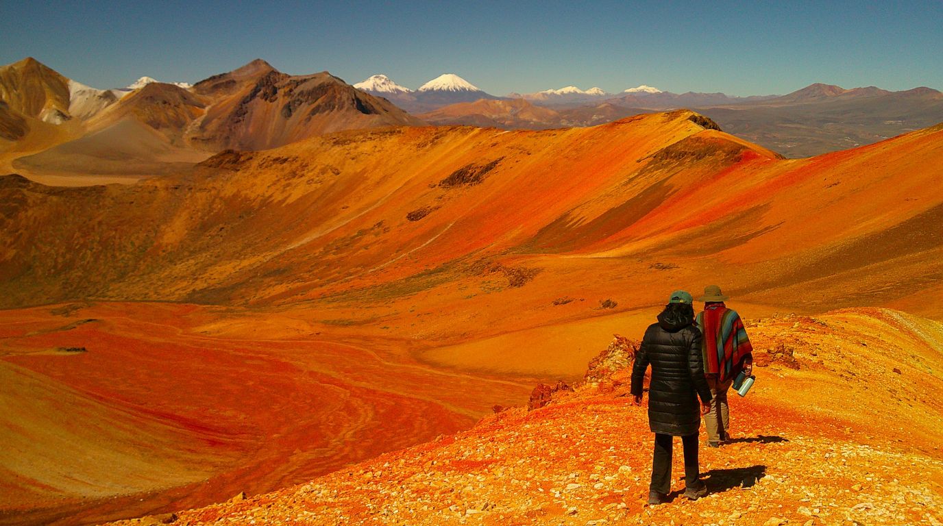
PARINACOTA · HIGH-ALTITUDE TERRAIN · GEOLOGY & EXPLORATION
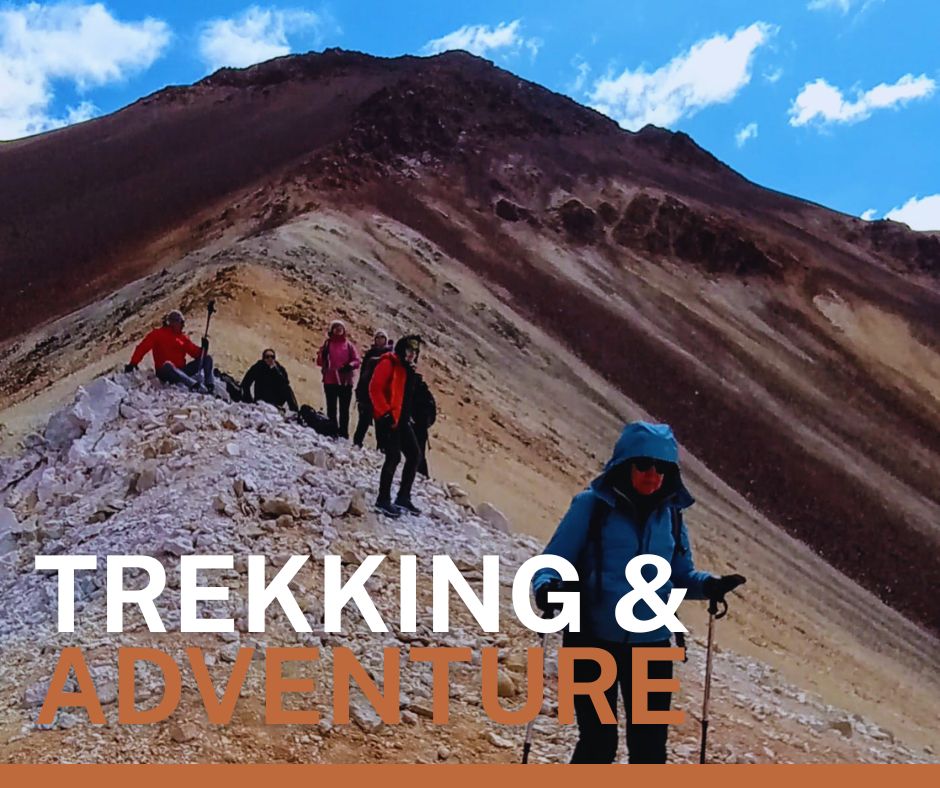
Suriplaza is one of those places where geology becomes almost impossible to ignore.
The mountains appear in contrasting tones—reds, oranges, ochres and darker volcanic colours—creating a landscape that feels almost abstract when viewed from a distance.
But the colours are not decoration.
They are the result of geological processes that have shaped the Andes over immense periods of time.
This is what makes Suriplaza particularly interesting for trekking.
The route is not only about physical movement.
It becomes an opportunity to understand how the landscape was formed.
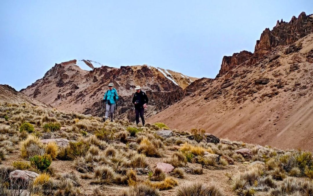
At elevations approaching and, depending on the route, exceeding 5,000 metres, the environment becomes increasingly demanding.
There is little shelter from wind or solar radiation. Temperature changes can be rapid, and the terrain requires attention to footing.
A trek here therefore combines several skills:
navigation, pacing, hydration, weather awareness and altitude management.
And then there is the cultural landscape.
Suriplaza lies within an Andean territory where communities continue to maintain relationships with the land, animals and routes that cross the highlands.
This is important.
The Altiplano is not simply a spectacular backdrop for adventure.
It is a living territory.
THE TREKKING EXPERIENCE
Best for: Geology · Exploration · Photography · High-altitude landscapes
Terrain: Open mountain terrain with uneven surfaces and exposed sections.
Altitude: High-altitude route; elevation varies according to itinerary.
Technical consideration: Strong exposure to altitude, weather and solar radiation.
Character: Geological · remote · exploratory.
The colours of Suriplaza are not simply something to photograph. They are part of the geological story of the Andes.
TREKKING ABOVE 4,000 METRES
THE TECHNICAL SIDE OF THE EXPERIENCE
High-altitude trekking is different from trekking at lower elevations.
Above 4,000 metres, the reduced availability of oxygen affects the way the body responds to exertion. The result can be a slower pace, increased breathing rate, quicker fatigue and longer recovery times.
That does not mean altitude should be feared.
It means it should be respected and managed intelligently.
ACCLIMATIZATION
The most important preparation for high-altitude trekking is allowing the body time to adapt.
Whenever possible, itineraries should increase elevation progressively rather than moving immediately from low altitude to demanding terrain.
PACING
Forget the pace you normally use at sea level.
High-altitude trekking is about maintaining an effort that you can sustain.
Shorter steps, slower movement and regular pauses are often more effective than pushing hard and stopping frequently.
HYDRATION
Dry air, wind and intense solar radiation can increase fluid loss.
Hydration should therefore be part of the trekking routine rather than something you remember only when you feel thirsty.
WEATHER
The high Andes can change quickly.
Sun, wind, cold and cloud can appear within the same journey.
Proper clothing should therefore follow a layering system, allowing you to regulate body temperature as conditions change.
NAVIGATION & TERRAIN
Open Altiplano landscapes can be deceptive.
Distances are difficult to judge, landmarks can appear similar and trails may not always be obvious.
Navigation, local knowledge and route planning become especially important in remote areas.
RESPECT THE TERRITORY
Many routes cross or approach Aymara territories and protected areas.
Responsible trekking means staying on appropriate routes, respecting community access arrangements, avoiding disturbance to wildlife and leaving no trace.
Altitude is part of the adventure — and part of the preparation.
WALKING THE HIGH ANDES
The highlands of Northern Chile offer a different definition of trekking.
Here, a route can lead through volcanic landscapes, wetlands, salt flats, mountain lakes and coloured formations—sometimes within the same journey.
But the real value of walking these landscapes lies beyond the physical challenge.
Trekking creates time to observe.
To understand why flamingos gather in a particular wetland.
To recognize the volcanic structure of a mountain.
To notice how the vegetation changes with elevation.
To understand that the same landscape that looks remote to a visitor is part of a territory with a long human history.
The Andes are not simply a place to conquer.
They are a landscape to read, respect and experience.
At Ruta Altiplano, we believe trekking should connect people not only with mountains, but with the landscapes, wildlife and cultures that give those mountains meaning.
This is high-altitude trekking in Northern Chile.
Not simply walking higher.
Walking deeper.
EXPERIENCE THE HIGH ANDES
TREKKING & ADVENTURE
Explore Northern Chile through high-altitude journeys combining mountain landscapes, wildlife, geology and living Andean culture.
EXPLORE TREKKING & ADVENTURE →